Pictures from my vacation: U.P.

kovacs32

Nipple show-er
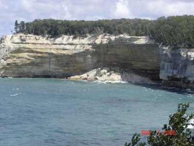
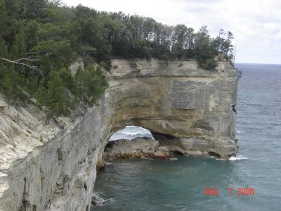
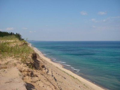
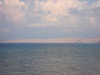
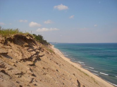
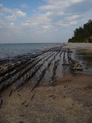
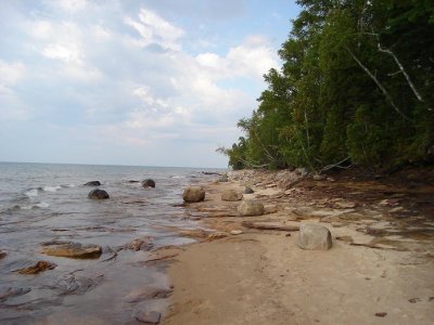
I went to the U.P. for a couple days earlier this month...finally got around to getting some pictures for you all. This is the pictured rocks and Au sable area on lake superior between Grand Marais and Munising. I really wish i coulda spent more than 4 days there....cant wait for next year.
 

Attachments

  • UP1.JPG
    UP1.JPG
    53.2 KB · Views: 118
  • UP2.JPG
    UP2.JPG
    63.6 KB · Views: 108
  • UP3.JPG
    UP3.JPG
    44.8 KB · Views: 106
  • UP4.JPG
    UP4.JPG
    41.5 KB · Views: 101
I took almost the exact same picture as "UP2" when I was up there almost two years ago. My girlfriends Dad has a cottage that has been handed down generations in his family. It sits right on Lake Suprior and is about 45 minutes east of Marquette. We were up there for a whole week though so we got to see quite a bit. Beautiful area up there. I'd love to go back again. Everything is so calm and relaxing man. Even the people don't really care about much.
 
Nice pics. I have never been up there, bit I think I need to go check it out one summer. Looks awesome with the scenery!
 
Love that area... I have been there many times but never in the summer, only in the snowy winter time on Snowmobiles!!!
 
Where were they all taken? (like exactly where if you can remember). I know the one looks like pictured rocks area, are the others there too? #3 looks amazing!
 
Pictures 1 and 2 are from the lake shore trail at pictured rocks Chaple rock hike (it was a 14 mile hike I took to get these pictures) Picture 3 I took after climbing to the top of the Grand Sable dunes, just 2 miles west of Grand marais. And the 4th pic is of the Grand sable dunes from A lighthouse that i hiked to from the Hurricane River campgorund, The dunes in the 4th pic are actually the same ones i took picture #3 from.

I will try to get more pics up, but i have 56k so its a timely process.

Ryan
 
More pictures...

Picutre 5 is also taken from the Grand sable dunes, if you look into the far distance to the right where the land goes out, at the end of that is where the lighthouse is where i took other picture of the dunes.

Picutre 6 is of the Shipwrecks froms 100's of years ago that are on the shore between hurricane river and the lighthouse, pretty sweet.

And picture 7 Is just of the shore in the same area as picutre 6.
 

Attachments

  • UP5.JPG
    UP5.JPG
    52.2 KB · Views: 19
  • UP6.JPG
    UP6.JPG
    66.9 KB · Views: 19
  • UP7.JPG
    UP7.JPG
    57.3 KB · Views: 19
heres some pics i took near traverse summer 04-05
100_0992.jpg
100_0989.jpg
100_0986.jpg
100_0980.jpg
100_0977.jpg
100_0973.jpg
100_240.jpg
100_237.jpg
100_229.jpg
 
Back
Top